 English
 Français
A public utility district needed updated ratings for about 24 miles of 115 kV transmission across six line segments. Our team performed the re-rating analysis from LiDAR survey data through delivered ratings:
- Modeled each segment in PLS-CADD from LiDAR and field records
- Checked NESC clearances at standard operating temperature limits
- Established the maximum safe operating temperature for each segment
- Delivered rating reports with plan and profile sheets
Each segment's rating traces to the specific spans that control it.
LINE MODELING
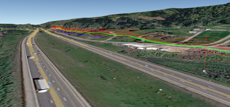
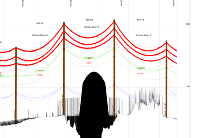
Segment models were built from LiDAR survey data and field records, including conductor types, attachment heights, and underbuilt distribution. Vegetation and terrain returns are carried in the model alongside the conductor.
CLEARANCE ANALYSIS
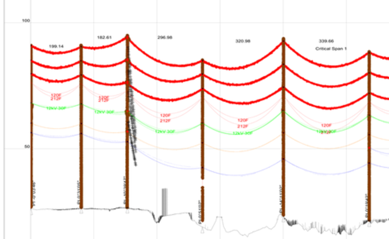
Each segment was checked against NESC clearances with the district's adopted buffers. Final sag was modeled under the code loading and ice cases for both the transmission circuit and the underbuild.
RATING DETERMINATION
The maximum safe operating temperature was established for each segment and converted to current capacity. The clearance-limiting spans are identified in the reports.
DELIVERABLES
The analysis report includes plan and profile sheets and LiDAR mapping for each segment.
BOTTOM LINE
- A district needed to know how hard it can run six transmission segments
- Our team delivered span-level ratings with the documentation to back them